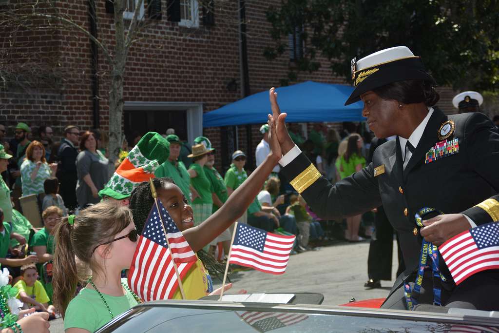
Categories
Events of note

Local chaos

Recovered from the Wayback Machine.

The shootings in Kirkwood happened about five miles from us. Kirkwood borders our community. My roommate and I were both shocked to hear of the shootings last night, especially since Kirkwood is considered a healthy, somewhat affluent, long-time community. It has great schools, thriving local businesses, good homes. What would make a man like Charles Thornton commit such an act in this quiet little community outside of St. Louis?

What confuses me more is the killer’s brother seeming to justify such killing. “Going to war”, over what? Parking tickets? Construction without permits and in violation of city building codes? Because he couldn’t disrupt community meetings?

In one of the local forums, a couple of people who were familiar with these community meetings mentioned that Thornton thought the community leaders were racist and were targeting him because he was black. That’s a serious charge, and if true, he should have worked with the state Attorney General and others to investigate whether prejudice was a factor, and he was being targeted. Yet he, seemingly, did nothing except show up for the meetings and call the council members and the mayor donkeys and accuse them of “plantation mentality”, bray during the meetings, and refuse to leave the meetings until he was arrested.

St. Louis Today article did get more specific, and stated that he felt he was being targeted for performing work without a permit and parking tickets. His mother states that it was wrong for him to kill, but it was wrong for others to drive him into killing. His brother mentioned that he was frustrated because he didn’t know the law.

Driving him into killing? Doesn’t know the law?

At one of the St. Louis Today talk threads, one person wrote:

Perhaps some of the prayers should be reserved for the cause of this event. The focus is always put on bullying in schools but what happens when those bullies grow up and then take positions on City Councils, Business Mgmt, etc.? They obviously pushed this man too far for someone to take this extreme measure. Kirkwood has a tendency to be uptight whites that have an issue with feeling superior to everyone else and I would say that attitude is common in several sub-communities in the St. Louis area – i.e. Chesterfield, Sunset Hills, Town and Country….. These communities need to look at how they are viewed externally. Sure many native St. Louisan’s have this problem also so they should step back also and realize in the grand scheme of things they are really nobody to push anyone else around.

First, and foremost–no one would take a gun into a city council and shoot people who is not mentally unbalanced. There is no ‘pushing’ into this kind of action. There is no excuse for what Thornton did, and I would be appalled at anyone who would think this action somehow justified.

I wonder, though, at the repercussions from this event. St. Louis and the surrounding communities do have problem. There isn’t enough diversification. The lines between black and white are too sharp. There is a tendency of the white governing bodies to ignore the black community and the problems of poverty that plague much of the community. Worse, there seems to be an underlying belief on the part of some community members, black and white, that nothing can fix the problems we have. That this community-based segregation will never end, never go away.

From what those who knew him have said in forums and elsewhere, Charles “Cookie” Thornton was a successful, well connected community member, with a loving family and friends. To go from that to cold bloodily shooting several people, killing at least five, is a disconnect I just can’t bridge with what we’re reading in today’s news accounts. I have a feeling this is only the start of the story.

Sad and troubling times in the neighborhood.

Categories
Environment Events of note Photography

A year in the life of Johnson’s Shut-Ins

One year ago, a billion gallons of water poured down a mountain, scraped away the dirt, the trees, the rocks, and any living thing in a flood of mud and debris. It landed at the entrance to Johnson’s Shut-Ins, slammed into the hill on one end of the park, swirled around taking away every last bit of the Ranger’s house, including the ranger, his wife, and their three small children.

A pickup and a large truck on the road suddenly found themselves adrift in the early morning darkness, as water shoved them into the field across from the Shut-Ins. A dump truck managed to stay grounded.

The water poured past and through the Shut-Ins–ripping away the campgrounds, pouring over the endangered fens, splashing against the hills on either side; dumping five feet of mud and boulders the size of cars in its path.

The residents of Lesterville waited, anxiously, to see if the lower reservoir held. It did.

If this had happened in the summer…

If the reservoir had not held…

From Black River News, many new stories:

More on the lawsuit

Ameren’s Press Release on the lawsuit

Ameren Fact Sheet

Leaked DNR Proposal

DNR and Childer’s response on the lawsuit and Black River News’ response

flood2.jpg flood3.jpg flood5.jpg
flood10.jpg flood13.jpg johnson22.jpg
postjsi1.jpg postjsi6.jpg postjsi9.jpg
js.jpg js2.jpg img01_110.jpg
dsc_0016.jpg dsc_0045.jpg dsc_0049.jpg
dsc_0161.jpg dsc_0162.jpg lizard.jpg
dsc_0179.jpg fall1.jpg fall2b3.jpg
Categories
Events of note Photography

Balloons

I went to the Forest Park Balloon Glow tonight. I didn’t get many good pictures–it was very crowded. My roommate went with me, and it was nice to have the company. We got lost afterward because our usual route home was blocked.

I picked out photos that I thought would tell the story of the evening.

Balloons

balloon4.jpg

(Check out the gas canisters for the Energizer Bunny balloon.)

balloon6.jpg

balloon7.jpg

balloon8.jpg

balloon9.jpg

balloon10.jpg

Categories
Environment Events of note

Johnson’s Shut-Ins: Then and now

The proposed new plan for the rebuilding of Johnson Shut-Ins park can be found here. As can be seen, the changes are rather drastic, including a restructuring of the stream through the park. Additional parking, scour overlook, new trails, new interpretive centers–the changes are rather extensive, and meant to support a larger number of visitors due to people coming to see the Shut-Ins and now the results of the dam break.


The camping has been moved, as no one was particularly interested in camping in a flood-plain valley with the reservoir dam being re-built.


A shuttle will move people about, and there’s also room for a helipad, though I imagine that’s for emergencies.


It’s certainly much grander than the old park. I spent time yesterday with several people who came out to see the park one last time before closing. One older gentleman told me tales of coming down with his uncle to fish by lantern light. He kept pointing out rocks hat didn’t belong in the shut-ins, and his eyes would, from time to time, tear up as he surveyed the damage.


Johnson Shut-Ins is gone. What replaces it will be nice, but it won’t be the same.


Note that according to state park employees, the park could be closed up to two years in order to do this restoration, starting


Monday, October 2nd.


Edited September, 2006


Johnson Shut-Ins will close for the winter this Monday, Oct. 2, for long-term repairs to be made. I visited today (Sept. 26th) and may go again this weekend, getting one last set of photos. I apologize for the scattered nature of the coverage and the Flash shows, but am planning on pulling them together into a complete show, along with details on the story of the dam break. When finished, I’ll add a link.


Edited June, 2006


I visited the park after it re-opened May 27th. The shut-ins are closed for swimming and exploration, though the boardwalk is open. The Ozarks Trail through that area is still closed, and efforts are underway to route around the damage. My plan is to pull together a more cohesive site incorporating all my photos and the story behind the dam failure, as well as the history (and future) of the park at Missouri Green.


The boulder field is a fascinating place, and the park has opened up that portion not being worked for exploration. If you’re into geology, this is a rare and rich opportunity.


Edited, 2/18/06


On December 14th, the Taum Sauk reservoir dam failed, sending a billion gallons of water rushing down the mountain; sweeping trees and boulders in its path, and cutting through the Johnson Shut-Ins State Park. This story is based on this event, and includes observations from a Department of Natural Resources (DNR) media tour held 02/09/06.

The first thing I noticed when driving to the Johnson Shut-Ins last week was the smoke of the burning pile of debris; appearing as a cyan-gray stream in the sky miles before the Shut-Ins turn off. A few minutes later I crossed the bridge over the Black River, passing a county sheriff’s jeep and then an AmerenUE’s security SUV, both parked by the side of the road.

The small, temporary trailer used by the work and security crew the last time I had been to the Shut-Ins had been replaced with a larger, more permanent looking construction trailer with a Dish Network satellite on top. I was early, and there weren’t many cars in the lot. I pulled up to the security gate to check in, passing two men wearing white vests with writing I couldn’t read, and carrying umbrellas who were standing on the road.

(Later I were to find they were members of the Teamsters, protesting Ameren’s hiring of non-union labor for the park restoration.)

Security is run by AmerenUE, which I thought was unusual. It’s true that the company is the one covering the costs of the restoration. However, Johnson Shut-Ins is a state park, and I assumed security would be managed by the state and then reimbursed by Ameren. Regardless, the gentlemen who stopped me had a clip board and when I mentioned I was there for the media tour, found my name, and passed me in.

As we waited for the tour to start, we were instructed to sign a disclaimer absolving DNR from responsibility if we hurt ourselves during the media tour. Once signed, we were issued bright fluorescent orange vests, and either orange or blue hard hats. These vivid colors stood out against the browns of the landscape, forming one of the strongest images I have from Thursday. Missouri is a place of muted color in the winter–brown, rusts, some green and the bright blue of the sky. But Johnson was almost a uniform brown of the silt and the rock that covered much of the park. So much so that the vests and hats the we all wore seemed preternaturally bright and alien.

After orientation, we were loaded into the vehicles to begin the tour. There were enough of us so that we were loaded into three vehicles. The largest bus/van was reserved primarily for the television crews as they needed the room. The smallest was a regular passenger mini-van. I sat in the second to the largest van with 12 others including Greg Combs from DNR, who ended up providing most of the information during the tour.

Instead of following the paved road into the park, we headed out onto the highway and from there entered a dirt road that had been carved into the debris field. The way was very rough, and we passed the burning pile that had sent the smoke I’d seen earlier into the air. A blower, named the Destructor, was sending air into the pile to keep it burning as hot as possible. Tractors and cranes were busy loading trees and bushes too damaged to be salvaged on to the pile, to be burned until reduced to ashes.

The field differed from the last time I visited the Park. Right after the flood, it was full of flattened trees and brush, and the only cleared area was around the Park Ranger’s home–the one that had been destroyed. I remembered the only green that showed at the time was from the flattened evergreens and, oddly enough, a cacti, damaged but still living in the dirt. Now there wasn’t a glimmer of green–it was all in browns with faint shadows of magenta from the pink granite in the area.

We bumped our way across the road until the river, stopping by a miniature lake formed by the scour of the flood; parking directly in the flood path from the mountain. Boulders pushed down the mountain lay tumbled along the side of the ‘road’– larger than some of the people walking around; almost larger than the vans. Across the river, these were joined by chunks of concrete and reebar from the dam itself, as well as the by now ubiquitous silt and black tarp.

The reporters with pads of paper and microphones and television cameras formed around Combs, as he explained much of what we were seeing. I walked around the newly formed lake, checking out the clarity of the river, but found my eyes drawn, time and again, to the path carved into the mountains. Standing there, you forget that the area around the river had once been all trees. Now, all around us was dirt and rocks. Everywhere. In the winter, we expect to see mainly brown in our forests. Come spring, though, when we normally expect the Missouri green to exert itself, we’ll really come to know this flood.

From the flood path, we loaded back into the vans and the next place we visited was what was once the campground area, and the special fen that was home to many endangered and rare plants. The campground and I believe the play area were basically one flat, featureless field. The only breaks were the concrete slabs that used to house RVs. Toward the park road and the fen area, though, there still were some standing trees. In and among these hardy survivors were dozens of workers and small tractors. The workers were digging at the dirt using shovels and pitchforks and loading the silt, by hand, into small sandbags.

In the area, plants currently dormant from the winter are buried by two to five feet of silt. If the ground can be uncovered by spring, there’s a chance to salvage these rare and precious bits of green. However, bigger equipment can’t be used or it could damage the already vulnerable area. Most of the work, then, has to be done by hand. To date, the effort has removed over 3000 dump truck loads of sediment, and 1625 truckloads of trees and related organic material.

At the fens, I talked for a time with an Ameren employee who hadn’t had a chance to visit the park since the flood. The Governor has been making all sorts of noises about pressing criminal charges from this incident, which is, in my opinion, absurd. Ameren had accepted responsibility for the event the day it happened, and hasn’t stopped accepting responsibility since. The company is funding the 60 or so workers currently clearing the dirt, as well funding recovery efforts for the river.

I asked the employee if the company was going to re-build the reservoir. She said they didn’t know yet, they were still exploring the options, how much they could guarantee that it wouldn’t fail and so on. I mentioned that whatever man can make, can break. She smiled ruefully and said she wished the engineers at the company would accept this.

(Since the tour I’ve read that an email was sent by one Ameren employee to others in September warning about previous overflows of the dam and its vulnerability. )

Our last stop was at the park store and would include a hike up the remaining park of the Ozark trail connected to the park, and to the Shut-Ins themselves. Normally I take the boardwalk, as it features one of my favorite tree-lined paths. However, the boardwalk was damaged and still hasn’t been recovered.

When we arrived, I again wondered off to watch the trucks loading up the organic material piled into a mountain in the parking lot. Returning to the group, one of the other reporters pointed out to me the different colors of wood along the store wall. He mentioned that this was the high water mark. I was surprised, as the park store is located on a hill some distance from the river.

In the back of the store area, salvaged picnic tables and bar-b-que stands lay in piles–all damaged beyond use.

We then headed toward the Shut-Ins, on foot. According to the reports, the Shut-Ins themselves weren’t damaged. They didn’t seem to be damaged, but I could see a great deal of silt and smaller rocks and trees tumbled about. More importantly, the silt had moved around the rocks, filling the hollows and spaces. I imagine that some rains will help wash some of this out, but it won’t happen quickly.

There’s hope to open the Shut-Ins for day use this summer, but after this tour, I’m not sure that’s going to be viable. One of the popular summertime uses of the Shut-Ins is swimming. No matter how careful the crew is on cleaning up, there’s going to be sharp edged pieces of concrete, rock, and reebar in and around the Shut-Ins for some time to come. If the state opens the Shut-Ins and doesn’t allow swimming, unless they staff the area, people will climb on to the rock, and paddle through the water.

In addition, I’m not sure that the Shut-Ins did manage to escape unscathed from that much water. One of the reporters, from the West Plain Quill, I believe, asked me if I remembered from my previous visits one particular cracked pink granite boulder on the other side of the river. I said I couldn’t remember it specifically. Combs came up and she asked him and he said it had been there, but shifted by the water. Checking my old photos, I do find the rock, and it does look shifted. More than that, some of the other smaller boulders also looked shifted.

If any of the boulders had been moved slightly from the force of the water, and silt pushed underneath, they might seem stable at first. However, as time goes on the and silt is washed away from the flow of water, these rocks could shift. More importantly, they could shift with people among them. The Shut-Ins will survive, but someone getting trapped under a boulder that moves unexpectedly may not.

Still, it was good to be at the Shut-Ins again. I’d forgotten how much I enjoyed the park, especially during the winter months, when I could visit and there wouldn’t be anyone about. This is unlikely to happen this winter. I can hope for next.

I was last leaving the Shut-Ins, and walked back with the temporary park superintendent. It was quiet in the woods, away from the cleanup effort and the jumble of orange vested press. We talked about how quiet the park normally is in the winter. For a moment, it seemed almost normal.

Back at the park store, they loaded us into the vans and dropped us back at our cars. The members from DNR, the park services, Ameren, were all universally friendly, helpful, and doing their best to be informative. One bit of humor from the tour is that people kept coming up to Greg Combs asking what his position was. Every time we would stop somewhere, another member of the press would come up and ask, “What’s your job with DNR”. “I’m Field Operations Manager”, he would patiently reply. At the end of the tour when he was helping us out of the van and reminding us to turn in the vests and hats, one last person asked the same question. When I shook his hand in thanks, I was tempted to suggest next time he have a t-shirt made up reading:

“I am Field Operations Manager”

There was also a town meeting later that evening, which I didn’t attend. The questions concerned how soon will the river clear and will they re-build the reservoir. I don’t know about the reservoir, but after the tour, I think the hopes on the part of some of the people in the area about the clarity of the river this summer are overly optimistic. That much silt won’t go away in a year. That much silt won’t go away in a decade.

(Later note: Ameren has decided to re-build the reservoir.)

As for the park, it will never be the same again. To paraphrase Field Operations Manager Combs, they won’t be recovering the park so much as carving a new one.

Categories
Environment Events of note

Unnatural Acts

Reporters checked with the Missouri state park system and found out, yes, the flood yesterday did a massive amount of damage to the Johnson Shut-Ins, most likely part of the Ozark Trail, and surrounding area. The trees and landscape in the following photo are most like gone now.

ironcountyfall1

It also sounds as if the park superintendent and his family who were hurt by the flood will recover, though the children are still in serious condition. All of us are thinking about what would have happened if this had been a peak weekend in the summer when the area gets anywhere from a thousand to two thousand people, on the trails and river, or in the campground.

Several people in the comment thread to the Topic of the Day discussion at St. Louis Today (the online site for the local newspaper, the St. Louis Post-Dispatch), mentioned about how this was a ‘miracle’ that no one was hurt. Thank God, they would say, that this wasn’t in the summer when more would have surely been killed; thank God that the family was found while they were still alive.

I wrote last night in the thread that this wasn’t a miracle; do they see God as this capricious being that destroys the dam just so he can swoop the family to safety, after first almost drowning them?

As sad coincidence would have it, I’m currently re-reading, Acts of God: The Unnatural History of Natural Disaster in America by Ted Steinberg. He writes in the introductory chapter:

Once, the idea of invoking God in response to calamity was a strategy for eliciting moral responsibility. In the twentieth century, however, calling out God’s name amounted to an abdication of moral reason. With the religiously inclined less disposed than ever to take acts of God seriously, the opportunity has arisen over the last century for some public officials to employ God-fearing language as a way–thinly veiled though it might be–of denying their own culpability for calamity. In this sense, the act of God concept has become little more than a convenient evasion.

A person who wrote that they were an employee of Ameren, wrote in comments to the Topic of the Day thread:

I WORK HERE AT AMEREN. THIS IS MOST DEFINATELY A MIRACLE. THERE IS NO DOUBT ABOUT IT. NOT A SINGLE LIFE LOST.

Yes, a miracle.

(Photos from St. Louis Today)