
Previous places I’ve lived have had emergencies that come up quickly and are usually over quickly. I’ve lived through a major ice storm in Grande Isle, Vermont, earthquakes in Washington and California, blizzards in Washington and Massachusetts, even Mount St. Helens, in Yakima, Washington.
A hurricane, though, is a different beastie. It’s like living in the land of giants and seeing a big ole shoe coming at you, and you can’t get out of the way. You’re waiting and watching. Waiting and watching.
We’re experiencing the impact of outer bands of Debby, which means periods of gusty winds, heavy rain, even a tornado watch, interspersed with periods of calm. Tonight and into tomorrow is when the real fun will start.
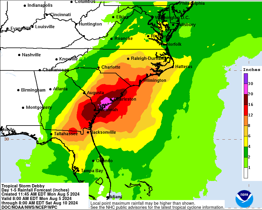
According to both Enki and NOAA, though we could get upwards of 15 inches of rain, the worst of the rain will likely occur in South Carolina. I’m sorry for our neighbors, but it’s not our fault and forgive us for being relieved. HOWEVER, not all of the models agree with this. Both the GFS and the ECMWF still show the major rain impact in our area.
(Edit: the GFS has since reversed itself, so the NOAA map seems more accurate all the time.)
Regardless, we’re going to get flooding rains. We already have a major river flood alert, and Savannah has put out warnings for so many roads that will flood that it’s just plain idiotic to drive tomorrow unless you must.
One of the bigger problems is community communication and its reliance on social media apps like X-witter, is not working well, and I’ll have more on this later this week. In the meantime, I’m just going to be sitting here, watching that shoe coming down.